![]()
 |
| 05-04-02 |
Bill Porter has a map of this ride on his web site. It is a bit older and depicts an older route that we used to ride but it at least gives you the lay of the land.
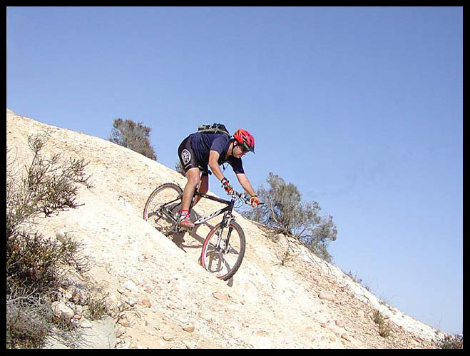
This is the very first video I did so I know it's a bit rough. I plan on re-shooting it the future but for now, this is it. I think my skills have improved since I put this one up but this one isn't that bad either. I will say right now that I crashed on the bridge when my chain dropped off my middle ring in the middle of the wheelie drop. I've done that maneuver many times prior to the crash, and many times since then. But, when the chain falls off after you've already started the wheelie drop, there isn't much you can do other than fall on your @ss!
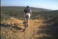
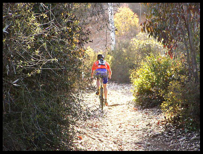
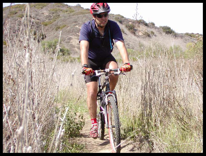
 Penasquitos Canyon is a fun place to ride that
is located right inside the city limits of San Diego. If you only read online
trail reviews, this place wouldn't sound very fun but the people who wrote the
reviews only stayed on the main canyon double track which is very boring.
all of the fun stuff is on the Del Mar Mesa to the North of the Park and while
legal to ride, doesn't seem to get much publicity.
Penasquitos Canyon is a fun place to ride that
is located right inside the city limits of San Diego. If you only read online
trail reviews, this place wouldn't sound very fun but the people who wrote the
reviews only stayed on the main canyon double track which is very boring.
all of the fun stuff is on the Del Mar Mesa to the North of the Park and while
legal to ride, doesn't seem to get much publicity.
The traditional trailhead is located off of
Sorrento Valley Road just East of the 805 freeway. A popular spot to park is in what used to be the old Cantina Bike Shop parking lot (an industrial complex
that has a lot of parking spaces available on weekends or after business hours)
because of the high rate of vehicle break-ins reported in the actual trailhead
parking lot. This parking location is easy to find because you just park
in the parking lot of the last building you see on your left. if all you
see is open space on your left, then you've gone too far. The actual
trailhead parking lot is located about 1/4 mile further East on your right but
as I said, I've heard rumors of vehicle break ins here.
what used to be the old Cantina Bike Shop parking lot (an industrial complex
that has a lot of parking spaces available on weekends or after business hours)
because of the high rate of vehicle break-ins reported in the actual trailhead
parking lot. This parking location is easy to find because you just park
in the parking lot of the last building you see on your left. if all you
see is open space on your left, then you've gone too far. The actual
trailhead parking lot is located about 1/4 mile further East on your right but
as I said, I've heard rumors of vehicle break ins here.
 Another place to park is on the east side of the preserve in Rancho
Penasquitos. The parking lot is located off of Black Mountain Road at the
end of Mercy road. There are actually two parking lots. One is an
athletic complex and is just North of Mercy Rd. This one is open later at
night so I just use this one when I park there.
Another place to park is on the east side of the preserve in Rancho
Penasquitos. The parking lot is located off of Black Mountain Road at the
end of Mercy road. There are actually two parking lots. One is an
athletic complex and is just North of Mercy Rd. This one is open later at
night so I just use this one when I park there.
The place we usually start the ride is in Carmel Valley though. I used
to live in some apartments at the end of Carmel Creek Road so we would just
start from there. I found a way onto the Del Mar
 Mesa so we can do a
complete loop with only minimal road riding. Another common starting spot
is at the bike trail parking lot on Carmel Country Rd. The only thing
tricky about starting at any of these locations is just knowing how to loop the
ride so that you get back to where you started.
Mesa so we can do a
complete loop with only minimal road riding. Another common starting spot
is at the bike trail parking lot on Carmel Country Rd. The only thing
tricky about starting at any of these locations is just knowing how to loop the
ride so that you get back to where you started.
the hill with the power lines on it. You want to go up there. There are
a couple of short but steep climbs to get you there but once you've climbed
them, you've done the hard part of the ride for a while. At the top of the
last climb past the gate, you want to look for a single-track on your left.
Take this one but don't turn off of it at any time until you join back up to the
double track. there is one spur trail on your left but it just leads back
down the hill to the horse ranch.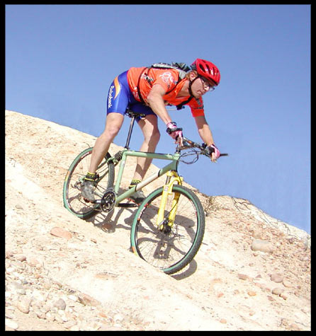
On the double track, you'll see a turn on your right that you'll take. You don't want to head down hill on any of the spur trails you'll see. Head South on the mesa and you'll pass some new construction. At the new construction, head East. On your left, you should see some houses. These are at the top of Carmel Country road. There should be a canyon in front of you with the houses on the left and nothing on the right. Head to the right. There's a single-track trail that takes you along the southern edge of this canyon and then into Penasquitos Canyon proper. It's not that hard to find but just keep an eye out for it. It's getting worse with the construction but enough people still ride it that you can spot it.
 Take the double track down the hill. You
should see the canyon below you. Before you gain too much speed bombing
down the double track though, keep an eye out for the single-track on your
right. Don't take the first ST that you see, but take the second one which
is at the top of a really steep hill. it will be on your right. take
this all the way down to Wagon Wheel Crossing in the canyon.
Take the double track down the hill. You
should see the canyon below you. Before you gain too much speed bombing
down the double track though, keep an eye out for the single-track on your
right. Don't take the first ST that you see, but take the second one which
is at the top of a really steep hill. it will be on your right. take
this all the way down to Wagon Wheel Crossing in the canyon.
Turn right and take this ST all the way to
Sorrento Valley Road. Cross the bridge and take the bike path behind the
post office. Follow the path and make your way through the parking lots
until you get to the road. Turn East on the pavement for about 1/8 mile
and turn into the preserve when you see the spot. Stay on the fireroad
until you get to the first LEGAL split in the road. Turn left and cross
the stream.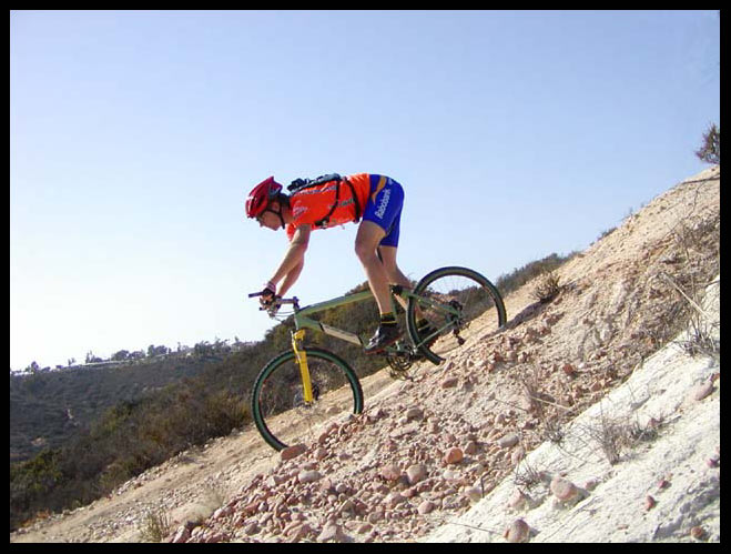
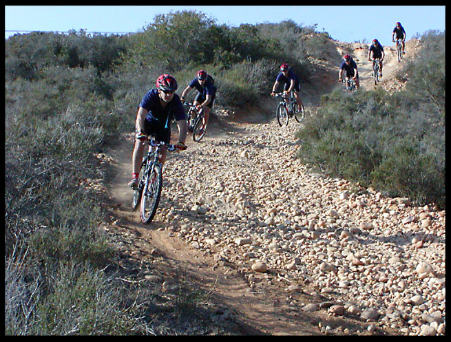
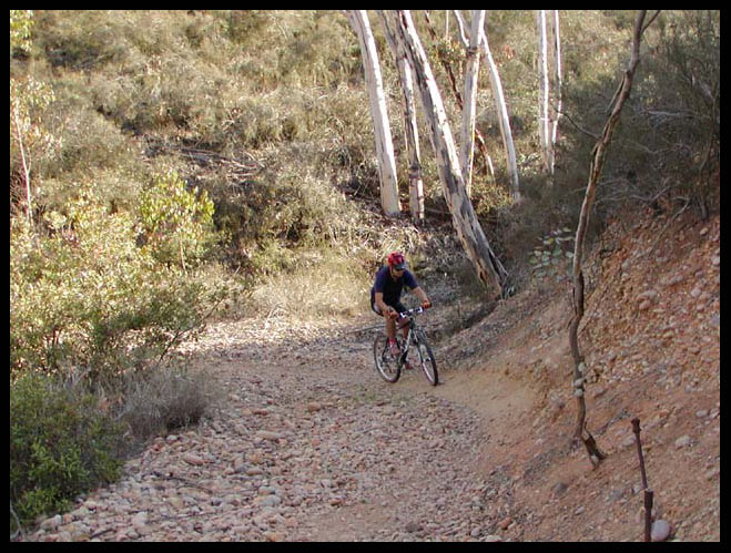
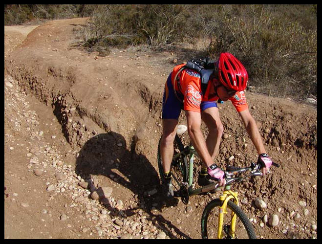
Stay straight and start climbing up Powerline Climb. at the top, turn left. Stay on the Fireroad and veer right when it, turn right to get to The Cobbles. There are two different cobbles but they both climb to the same spot. The first left you see is what we call "Big Cobbles" because it's steeper. If you keep going, you'll go up "Little Cobbles". Either way is fun and challenging since the trail is made up of small baby-head rocks that are very loose.
At the top, you'll be on a Mesa. Find the
fireroad by heading basically straight from where you climbed up the hill.
The fireroad will more or less parallel the power lines and you want to continue
in this general direction. However, there are
 several side trails that are
much more fun than the fireroad. The first single-track side trail is on
the right about 300 feet from where the fireroad begins. if you stayed on
the fireroad, you'd see ST, double track, single-track in about 1/8 of a mile so
just make sure you take the first ST. The first ST ends where the second
ST joins the FR so you gain a mile of ST rather than a short fire road stretch.
Just stay on the ST when it crosses the double track and get back to the main
FR. At the FR, turn right and take the next ST right turn you spot in
about 1/8 mile.
several side trails that are
much more fun than the fireroad. The first single-track side trail is on
the right about 300 feet from where the fireroad begins. if you stayed on
the fireroad, you'd see ST, double track, single-track in about 1/8 of a mile so
just make sure you take the first ST. The first ST ends where the second
ST joins the FR so you gain a mile of ST rather than a short fire road stretch.
Just stay on the ST when it crosses the double track and get back to the main
FR. At the FR, turn right and take the next ST right turn you spot in
about 1/8 mile.
There are several spur trails along this that
are all on your left. They all just go back up to the main FR so don't
take any of them. Just keep turning right for the next couple of miles.
You'll join up with a FR and you should see a chain link fence in the distance
ahead of you. Ride towards the fence but turn left on the double track
before you get to it. You can stay on the ST and follow the canyon lip or
you can drop down into the canyon on the first right hand turn. take the
descent to the bottom and turn left to climb back out. At the top of the
climb, turn right onto the ST (the one you would be on if you didn't drop into
the canyon) until it connects with a FR.
them. Just keep turning right for the next couple of miles.
You'll join up with a FR and you should see a chain link fence in the distance
ahead of you. Ride towards the fence but turn left on the double track
before you get to it. You can stay on the ST and follow the canyon lip or
you can drop down into the canyon on the first right hand turn. take the
descent to the bottom and turn left to climb back out. At the top of the
climb, turn right onto the ST (the one you would be on if you didn't drop into
the canyon) until it connects with a FR.
 When you get to the FR, turn left and then take
the first right to follow the ST along the top of the canyon. You'll come
to a short downhill that continues straight or has a hard right hand turn.
Turn right
When you get to the FR, turn left and then take
the first right to follow the ST along the top of the canyon. You'll come
to a short downhill that continues straight or has a hard right hand turn.
Turn right to go all the way to the bottom. At the bottom, turn left to climb out.
At the very top, take the hard right to get over to the housing development.
At the road, continue past two stop lights. after the second stop light,
look for a trail by the third or fourth street light. take this and follow
it making all right turns. This trail parallels Carmel Country road.
When it ends, take the paved driveway for about one hundred feet but look for a
trail that follows the cement drainage culvert. take this trail which
opens up to dirt road. at the gate, you're at the bike trail along Carmel
Country road. Simply take the bike trail West back to Carmel Creek Road to
finish the ride.
to go all the way to the bottom. At the bottom, turn left to climb out.
At the very top, take the hard right to get over to the housing development.
At the road, continue past two stop lights. after the second stop light,
look for a trail by the third or fourth street light. take this and follow
it making all right turns. This trail parallels Carmel Country road.
When it ends, take the paved driveway for about one hundred feet but look for a
trail that follows the cement drainage culvert. take this trail which
opens up to dirt road. at the gate, you're at the bike trail along Carmel
Country road. Simply take the bike trail West back to Carmel Creek Road to
finish the ride.
 There are other variations depending on where
you start so it just take a little time to figure out where you are and how to
get to where you want to go. It's not hard since the park is bordered on
all four sides by developments but at times it can become a little disorienting.
The nice thing is that if you are pressed for time you can cut parts out to
shorten the ride while still getting in a decent ride.
There are other variations depending on where
you start so it just take a little time to figure out where you are and how to
get to where you want to go. It's not hard since the park is bordered on
all four sides by developments but at times it can become a little disorienting.
The nice thing is that if you are pressed for time you can cut parts out to
shorten the ride while still getting in a decent ride.
This ride is just around 19 miles in length and is quite challenging although
not a killer like some rides can be. There's a herd of deer that reside in the
canyon so depending on the weather and time of day you have a good chance of
seeing them. There's also a ton of rattlesnakes and tarantulas so keep your
eyes open.
Because it's fairly easy to become disoriented while riding the north part of
the park, just keep the power lines in sight and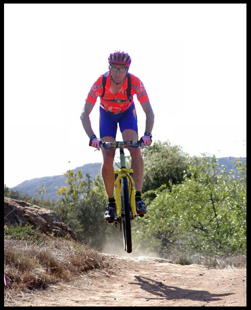 follow them. You will end up
directly under a power line tower so as long as you always know where you are
relative to the power lines you can't get lost. Since the fireroad also runs
under the power lines, you can always re-orient yourself simply by locating the
fireroad at any time during your ride.
follow them. You will end up
directly under a power line tower so as long as you always know where you are
relative to the power lines you can't get lost. Since the fireroad also runs
under the power lines, you can always re-orient yourself simply by locating the
fireroad at any time during your ride.